
From roadside markers to courthouses, cemeteries, museums and the spots locals swear by — TexasRoam maps the stories worth pulling over for, and lets you collect them as you go.
Built on the official Texas Historical Commission Atlas — real, state-maintained data — then layered with the iconic and the can't-miss.
TexasRoam is more than a map. The app unlocks 500+ self-guided audio tours — walking and driving — and 3,500+ hiking, walking & biking trails across Texas. Chase historic downtowns and railroad towns, haunted-cemetery ghost tours, JFK & the presidents, Texas outlaws, WWII & military history, film locations and more. Tours & Trails are in the iOS app only — not on the web map.
Walking and driving tours across Texas — historic downtowns, railroad towns, haunted-cemetery ghost tours, JFK & the presidents, outlaws, WWII and film trails. The history read aloud stop by stop, with directions and check-ins built in.
Hiking, walking, biking, mountain-biking and horseback trails statewide — loops and point-to-points, each with length, surface and difficulty so you can plan the walk and follow the path.
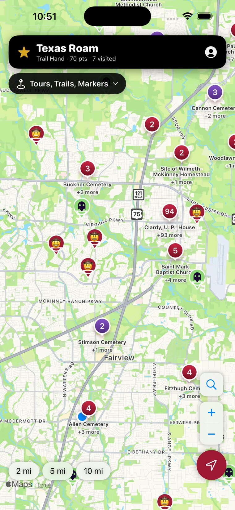
Open the map, set your radius, and see every marker and landmark within driving distance — color-coded by type.
Tap any site for its inscription, history and context — plus one-tap directions in Apple Maps.
Arrive and check in. Visited spots turn gold and count toward your rank as you roam the state.
Thousands of sites on one live map, and a rank that grows every time you stop.
Filter to a single category and TexasRoam changes its skin — custom map art, colors and a little personality for whatever you're chasing. (Try the buttons up top!)
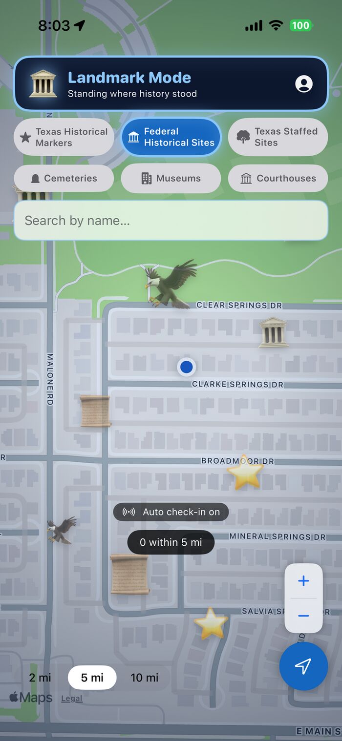
Standing where history stood.
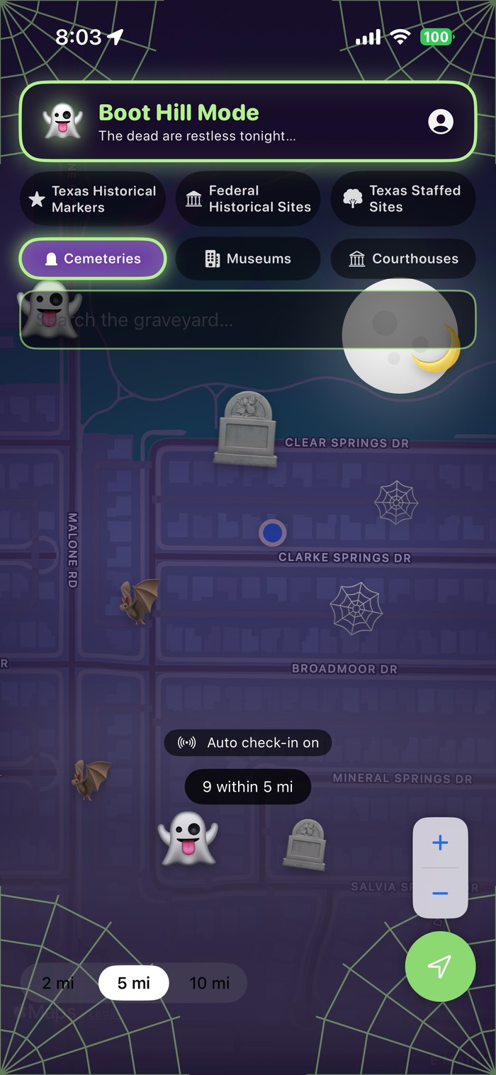
The dead are restless tonight…
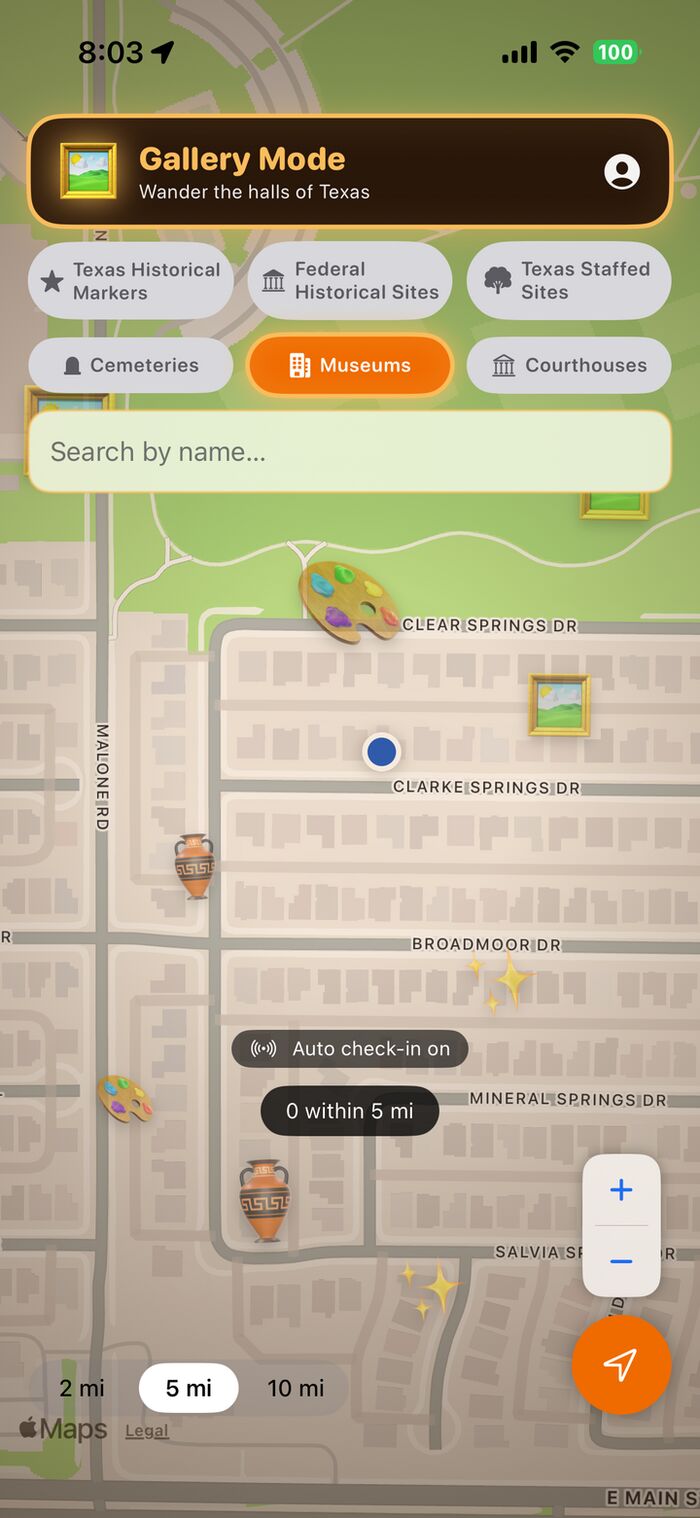
Wander the halls of Texas.
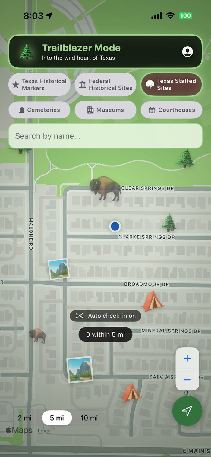
Into the wild heart of Texas.
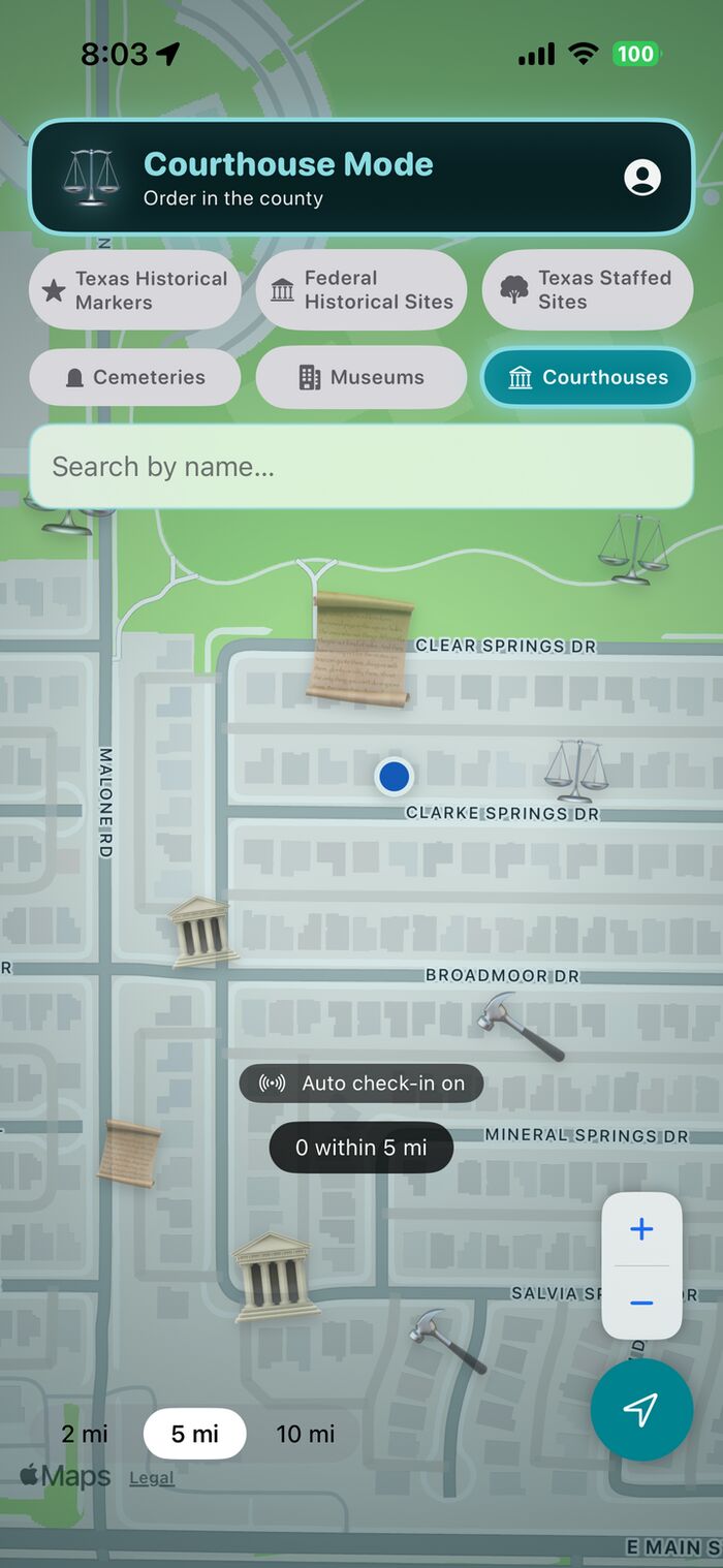
Order in the county.

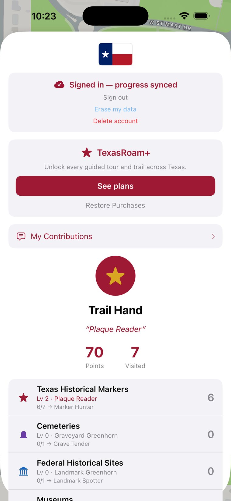
Every visit earns points and climbs a Texas-flavored ladder. Rack up a county and you might just become King of Dallas County.
All 28,000+ sites on one live map — search, “near me,” directions and check-ins. Free and ad-free. Your visits, points and rank sync across the iOS app and the web on the same Apple account.
Prefer the browser? Open the web app → (free, Apple ID required) — note: Guided Tours & Trails are in the iOS app only, not the web map.
The TexasRoam iOS app is live on the App Store — free and ad-free. Put every Texas marker, courthouse, cemetery, museum and landmark in your pocket.
Free · ad-free · iPhone & iPad. Or open the web app →